
Waheed Uddin
Ph.D., The University of Texas at Austin, 1984
M.S., Asian Institute of Technology, 1975
B.S., University of Karachi (NED Engineering College), 1970
Inducted, 2014
Waheed Uddin has distinguished careers in consulting and education. He is currently a professor of civil engineering at the University of Mississippi and the founder and director of the Center for Advanced Infrastructure Technology (CAIT). He has 40 years of professional and research experience in highways, airports, air quality, traffic management, infrastructure and environmental sustainability.
After graduating from The University of Texas at Austin, he worked as a pavement engineer for Austin Research Engineers, Inc. and then as a research engineer for the Center for Transportation Research. He has also served as a pavement expert for the United Nations, living abroad in the United Arab Emirates, and then as a consultant for the World Bank Project for the Indonesian Toll Road Authority.
He joined the faculty at Ole Miss in 1993 as an assistant professor. A full professor since 2007, he also served as the civil engineering graduate coordinator and acting department chair. He has been the director of the Center for Advanced Infrastructure Technology (CAIT) since its establishment in 1999.
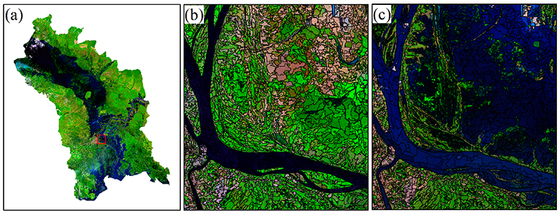
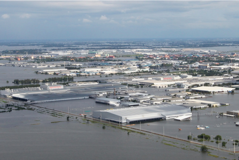
Waheed is a pioneer in evaluating laser remote sensing terrain scanning technology and geospatial analysis for infrastructure development and environmental applications. His transportation and flood inundation mapping products were implemented for the 2005 Hurricane Katrina impact assessment on the Mississippi Gulf Coast, the post-2010 floods in Pakistan, and the 2011 floods in Thailand.
He has published four books, one book chapter and over 150 papers and technical reports. Additionally, Waheed has worked and lectured worldwide in 27 countries and made over 135 presentations, including 40 invited lectures and keynote speeches at national and international meetings.
In 2015, he was awarded the Senior Faculty Research Award from the School of Engineering at the University of Mississippi. Waheed is also an ASCE life member for his lifelong dedication and service to the engineering profession.


