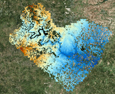
 Road
Elevation Model
Road
Elevation Model
1-Page Description RoadElevationModel1Pager.pdf
Video: https://youtu.be/CcjO0Mgj_10
Short Video: Road Elevation Model
Viewer: https://viewer.copc.io/
Sample Dataset for Viewer: road.copc.laz (1.9 GB) https://tinyurl.com/4f2b3nus
Sample Dataset for Analysis: travis_road_lidar.laz (1.9 GB) https://utexas.box.com/s/5dqn7kf9x2md2z32udxo354a0dk9d8a6
Direct Viewing on the Web: https://viewer.copc.io/?copc=https://txbridge-data.s3.amazonaws.com/road_elev_model/road.copc.laz
Road Elevation Model Data
By Maintenance Sections:
By Counties: https://web.corral.tacc.utexas.edu/nfiedata/road3d/austin_district/AustinCounties_H_epsg6343_V_epsg5703/
Tutorials
1-Page Summary: Road
Elevation Model Tutorials
Tutorial 1: Building a Road Elevation Model
of the Shoal Creek Watershed
Tutorial 2: Flood Inundation Map for Anderson Lane at Shoal Creek
Tutorial 3: Impact on Roads of a 100-Year
Flood in Shoal Creek
Tutorial 4: Box Culvert on IH-10
Tutorial 5: Rating Curve using HY-8
Southeast Texas Terrain and Hydrography Data
Elevation-Derived Hydrography from 1m DEM’s is accessible
at: https://rockyweb.usgs.gov/outgoing/ClaireDeVaughan/SETX%20EDH/
The methods used to develop this dataset are described at:
2023-03-15-NSGIC_Hydro-enhancement_Presentation_IPDS_Approved.pdf
A 1-m Topobathy surface for Southeast Texas is at: Danielson, J.J., Miller-Corbett, C.D., and Thatcher, C.A., 2023, Southeast Texas Pilot National Topography Model (NTM), 1933 to 2021: U.S. Geological Survey data release, https://doi.org/10.5066/P9N4WLC8.
The methods used to develop this Topobathy surface are described at: Danielson.pdf