 |
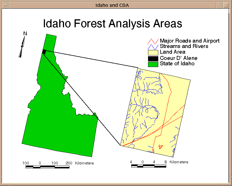
New Study Area |
|
New Study Area |
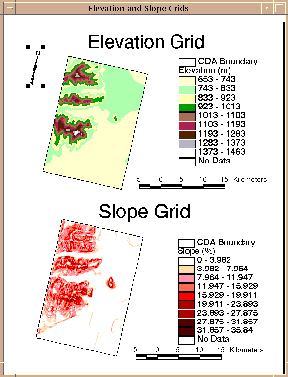 |
CDA Slopes and Elevation Data |
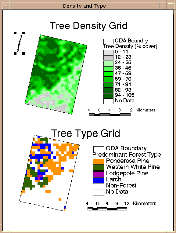 |
New Density and Re-Sampled Type Grids |
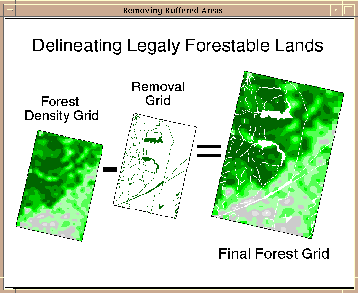
The map below summarizes a conceptual model for construction of the removal map. Once the hydrology and roads have been buffered, these coverages are converted to grid or raster format. From there they can be combined along with the exceedance slope values to form the total removal grid. The cells in the total removal grid are areas where forestry will not happen legally.
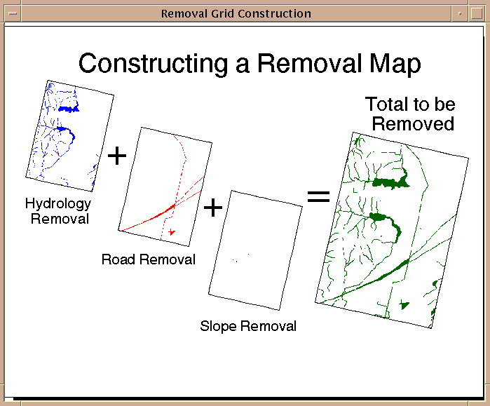 |
Construction of the Removal Grid |
The following map shows how the "total removal" (the sum of buffered road and river data as well as extream slope data) is taken from the interpolated forest density map to create a new Legally Forestable Map, or lands that are able to be cut.
 |
Removal of the Buffer Zones |
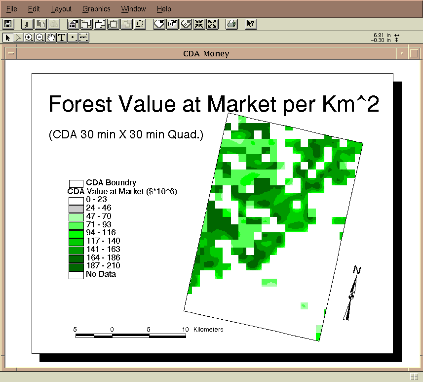
For an analysis of the entire state of Idaho the map above can be combined with a normalized version of the forest type value map (see Idaho Analysis Page) to yield the map below. The analysis shows that areas around roads and streams are of little commercial value while areas that are densely forested can be worth a high value.
 |
Show Me The Money - A second time! |
Although this analysis is in some ways unrealistic (e.g., missing data, coarse data, small scale) it still serves a purpose. First, it was an exercise in using vegetation data. Second, these maps can easily be used for screening tools to decide where a company should invest in a detailed survey of economic feasibility. Third, the objectives of the study were accomplished. Lastly, this study paves the way for possible future work on time variant parameters such as future forest values.
Some suggestions for future work:
1. Expand detailed DEM’s and Digital Line Graphs (DLG’s) to entire state.
2. Find and utilize more accurate forest maps.
3. Incorporate data on national and state parks, Indian reservations, wilderness areas, private and
municipal land holdings and recently cut forest regions.
4. Examine how forest volumes relate to % forest cover.
5. Bring soil, rainfall, sunlight data into analysis to possibly predict future tree growth and
values.
6.* Bring tree counting into the analysis (remote tree volume quantification - that'll piss of a few foresters!)
I believe that GIS is a wonderfully powerful tool. However, after finishing this project I can’t help but feel that this tool "de-naturalizes" the process of forestry. I think that it is hard to realize the magnitude of a 1000 m by 1000 m cell - that’s thousands of trees - probably millions, yet it is so small on the computer screen. GIS allows us to quantify forestry on the large scale. GIS gives us the ability to see the whole picture. Whether this is good or not is not for me to decide. The decision will be made by those that make their livelihood in the woods. Hopefully, forestry and GIS can be combined in a way where all variables are included. Even with this there is no guarantee that those involved will choose to see the whole picture. Never the less the decision will be made.
I stand down.............................................................
(c) Copyright Mike McAdams, 1997
if you want something e-mail me at: