Slide 7 of 19
Notes:
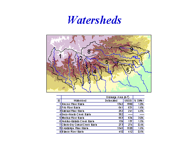
Southern boundary of the drainage basins are defined by stream gages that�were placed below the recharge zone based on seepage studies
- Their locations define the pour points for the delineated watersheds
To increase accuracy, a special procedure was used
- The burn-in procedure was developed by the Center for Research in� Water Resources (CRWR)
- A coverage of streams digitized from aerial photographs is burned-in� to the DEM to force the grid stream network to agree more closely� with reality
The areas of the resulting drainage basins were consistent with those�cited by USGS