Slide 5 of 19
Notes:
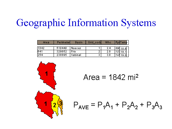
- Each feature is referenced to a table using a unique ID
- Layers describe climate, elevation, soil properties, etc. were compiled� for this study
GIS is a powerful tool for spatial analysis, used to:
- Delineate watersheds in the Edwards region
- Interpolate climate from 0.5° by 0.5° grid to watersheds
- Derive average soil-water holding capacities