
Development and Calibration of a Hydrologic Model for the Wichita Falls District
Progress Report
GIS in Water Resources, 10/24/00
The focus of this project is to develop a hydrologic model for a TxDOT highway drainage structure. In the first stage of this project I use a spatial data preprocessor, CRWR-PrePro, developed by the Center for Research in Water Resources (CRWR), to calculate hydrologic parameters of the floodplain. The second phase of this project involves using HEC-HMS to calculate the hydrograph based on the parameters determined by CRWR-PrePro. HEC-HMS (Hydrologic Modeling System) is a flood package developed by the US Army Corps of Engineers Hydrologic Engineering Center at http://www.wrc-hec.usace.army.mil/.
I first identified the TxDOT Wichita Falls district from the TxDOT web site http://www.dot.state.tx.us/insdtdot/geodist/wfs/wfsdist.htm. This northern Texas area is formed by seven counties: Archer, Baylor, Clay, Cooke, Montague, Throckmorton, Wichita, Wilbarger and Young.
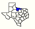
Wichita Falls TxDOT District (highlighted in blue)
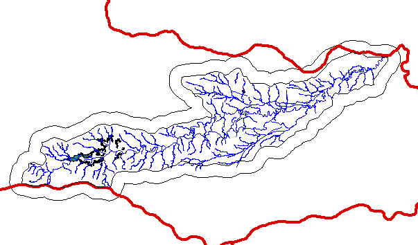
As this area is very large, I specifically have decided to focus in the region encompassed by cataloging unit 11130206. This is an arbitrary location to conduct this analysis, since the exact location of the TxDOT drainage structure to be analyzed is not yet known. Once I decided which cataloging unit I was going to be working with, I then buffered the unit using the ArcView Theme/Create Buffers command.
The next step involved obtaining the digital elevation data (or Digital Elevation Models, DEMs) for cataloging unit 11130206. The resulting 30-m DEMS are 9934, 9835 and 10034 where the first 2-3 digits represent west longitude, and the last two digits north latitude in geographic coordinates. I obtained these DEMs from the CRWR database, but they can also be downloaded from the USGS National Elevation Dataset (NED) website http://edcnts12.cr.usgs.gov/ned/.
With the known HUC I downloaded the corresponding National Hydrography Dataset (NHD) stream networks and waterbodies from the NHD website http://nhd.usgs.gov. The following picture shows the NHD data, basins shapefile, HUC 11130206 and buffered HUC 11130206.
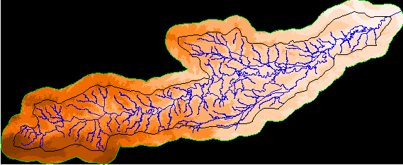
After merging the three DEMs, the process of delineating the watersheds and stream networks begins. I have just begun this process, and have burned in the streams with the Burn Streams CRWR-PrePro command, using an arbitrary elevation of 5000m.
The next steps involve using CRWR-PrePro to fill sinks, compute flow direction and flow accumulation grids and construct the stream network. Once the watersheds have been delineated, I will use HEC-HMS to develop the hydrograph for a specific reach in the cataloging unit. This reach has not yet been determined.