Prepared by Pawel J. Mizgalewicz and David R. Maidment
The complete description of the methodology can be found in:
Mizgalewicz, P.J., and D.R. Maidment
Modeling Agrichemical Transport in Midwest Rivers using Geographic Information
Systems, CRWR Online Report 96-6, December 1996.
This exercise is intended to be performed with a Geographic Information System (GIS) program called ArcView. You may use anycomputer running ArcView 3 or later, under Windows OS. An introduction to ArcView exercise is available on-line and on the GISHydro97 CD rom.
In addition to ArcView you will need some programs developed by our research group. The programs are packaged in something called a project which you can load into ArcView like a file.
The data consists of:
These files are contained in the directory \gishyd97\loads\agrimod\agrichem. Two versions of the data are available, one with the files as shown above, and another with the files in zipped form. The options for reading the data and advantages and limitations of each are explained below.
Tha primary goal for this exercise is to demonstrate the application of GIS to analyze river pollution. The capabilities of this model will be presented using a herbicide, atrazine, and a nutrient, nitrate plus nitrite as nitrogen. The steps of the exercise are displayed on the light-blue background. Please, write me if you have any comments: pawel@crwr.utexas.edu
The ArcView application is divided into four projects (a project is a collection of associated documents: views, tables, layouts, charts, and scripts). Each project is designed to perform a different task. Four buttons that allow user to switch between projects have been placed in the Button Bar. These buttons have the following functions:
![]() Runs
the "model" project. This project is designed
to prepare entry data for the agrichemical transport model as well as to
calculate concentrations and loads.
Runs
the "model" project. This project is designed
to prepare entry data for the agrichemical transport model as well as to
calculate concentrations and loads.
![]() Runs
the "results" project which is designed
to display the results as maps of agrichemical concentration and load.
Runs
the "results" project which is designed
to display the results as maps of agrichemical concentration and load.
![]() Executes
project "flwprc" which provides visualization
of the flow record for a selected modeling unit.
Executes
project "flwprc" which provides visualization
of the flow record for a selected modeling unit.
![]() Project
"tools" contains the fundamental tools for
hydrologic modeling.
Project
"tools" contains the fundamental tools for
hydrologic modeling.
The project "model" is the main component of the ArcView application. Projects "results", "flwprc", and "tools" are supporting modules.
|
When opened, the project Model displays the following maps:
Six buttons are designed to select different activities:
![]() Edit
Application. This button displays dialog boxes that allow the user to specify
the agrichemical application rate. If the view-window Application Rate
is active, the application in either all, or selected counties can be specified.
If the view-window Modeling units is active, the application rate
in each modeling unit can be modified.
Edit
Application. This button displays dialog boxes that allow the user to specify
the agrichemical application rate. If the view-window Application Rate
is active, the application in either all, or selected counties can be specified.
If the view-window Modeling units is active, the application rate
in each modeling unit can be modified.
![]() Edit
Cumulative Flow Rate. This button shows dialog boxes for selecting the
flow record (by selecting a year) that will be used for calculations and
for adjusting the selected values. For example, all data can be multiplied
by a factor that represents extreme conditions. The adjustment may be performed
for all months of the specified year or for each individual month.
Edit
Cumulative Flow Rate. This button shows dialog boxes for selecting the
flow record (by selecting a year) that will be used for calculations and
for adjusting the selected values. For example, all data can be multiplied
by a factor that represents extreme conditions. The adjustment may be performed
for all months of the specified year or for each individual month.
![]() Select
Year. This button allows the user to specify a year for a model that has
a trend component. There is no trend in the current model.
Select
Year. This button allows the user to specify a year for a model that has
a trend component. There is no trend in the current model.
![]() Select
Model. The dialog box displayed by this button displays available models
from which the user has to select an equation. This equation will be used
to calculate agrichemical concentrations.
Select
Model. The dialog box displayed by this button displays available models
from which the user has to select an equation. This equation will be used
to calculate agrichemical concentrations.
![]() Run.
Executes the script that performs the calculations.
Run.
Executes the script that performs the calculations.
![]() First
Order Reaction. Calculates concentrations and loads assuming exponential
decrease of the agricultural constituent along the flow path. The current
model does not contain a map of spatially distributed decay rates that
allows one to estimate concentrations by this method.
First
Order Reaction. Calculates concentrations and loads assuming exponential
decrease of the agricultural constituent along the flow path. The current
model does not contain a map of spatially distributed decay rates that
allows one to estimate concentrations by this method.
The following coverages and data files constitute the core database of the model:
| Field (Item) | Description |
| Fips | county FIPS code |
| St | state |
| Cntyname | county name |
| N89kgkm2, N90kgkm2, N91kgkm2 | estimated average nitrogen fertilizer application rate for the years 1989, 1990, and 1991, respectively [kg/km2] |
| A89kgkm2 | estimated average atrazine application rate for 1989 [kg/km2] |
| Temp | field reserved for storage of results of partial calculations |
| Use | application rate selected for the estimation of concentrations and loads |
| Field (Item) | Description |
| Unit_id | ID of the modeling unit |
| Gswsh | ID of the USGS gauging station downstream of the modeling unit |
| Unit_nx | ID of the next unit on the flow path (downstream unit ID) |
| Order | a number that specifies location of the unit on the flow path |
| Areakm2 | area of the unit [km2] |
| Careakm2 | drainage area upstream of the unit outlet [km2] |
| Alndslp | average land slope of unit drainage area |
| Alndlgkm | average length on the flow path from the land to the stream network [km] |
| Chemuse | Agrichemical application rate in the unit [kg/yr/km2] |
| Cchemuse | average agrichemical application rate over the unit drainage area [kg/yr/km2] |
| Travtime | travel time across the unit [d] (no data available) |
| Losscoef | Overall loss coefficient in the unit [1/d] (no data available) |
| Expofact | Export factor, fraction of the applied agricultural chemical in the unit that enters the surface water (no data available) |
| Tcavg | Annual average temperature for upstream drainage area [°C] |
| Pmmavg | Annual precipitation depth, average over upstream drainage area [mm] |
| Flow01...Flow12 | monthly flow rate that flows through the unit outlet [m3/s] |
| Conc01...Conc12 | concentration at the unit outlet (atrazine [mg/m3], nitrate plus nitrite as nitrogen [g/m3]) |
| Load01...Load12 | chemical load (flow * concentration, atrazine [mg/s], nitrate plus nitrite as nitrogen [g/s]) |
| Field (Item) | Description |
| Year | a year that is used to estimate the trend coefficient; |
| Ftrend | mathematical description of the trend. Current version of the model assumes no trend, i.e. the trend is described by the following equation: 1.00+(0.0000*Year) |
| Trendcf | trend coefficient which is calculated according to the information stored in items Year and Ftrend |
| Si01...Si12 | seasonal index, 12 values that represent the monthly variations of the agrichemical concentration around the annual average. |
| Model | model name, e.g. Nitrate01, Atrazine01, Atrazine02 |
| Sel | contains 1 if the model is selected for calculations, 0 otherwise |
| Equation | equation for estimation of agrichemical concentrations.
Four models are available,
Three multiplicative models are included only for testing purposes:
where: U = application rate, A = drainage area, Q = flow rate, LL = average overland flow length, SL = land slope, TA = average temperature, PA = average precipitation, TR = trend coefficient, and SI = seasonal index. |
| Comments | comments and model description |
The ArcView script equat6 executed from the button ![]() calculates
concentrations and loads. This script first selects the record that contains
the value of item [Sel] equal to 1. Then equat6 extracts the value
from the item [Year], retrieves the equation that describes the trend from
the item [Ftrend], calculates the trend coefficient, and stores it in the
item [Trendcf]. In the next step, the script extracts the equation from
the item [Equation] and replaces the symbolic names U, A, LS, LL,
and Q with the corresponding item names [Cchemuse], [Careakm2],
[Alndslp], [Alndlgkm], and one of the item [Qm01]...[Qm12]. The symbolic
name TR is replaced by the value stored in the item [Trendcf] and
the name SI is replaced by the value from one of the items [Si01]...[Si12].
The concentrations are calculated for each month of the year by the Avenue
request calculate and the results are stored in the items [Conc01]..[Conc12].
The loads are estimated by multiplication of the flows and concentrations.
The products are stored in the items [Load01]...[Load12].
calculates
concentrations and loads. This script first selects the record that contains
the value of item [Sel] equal to 1. Then equat6 extracts the value
from the item [Year], retrieves the equation that describes the trend from
the item [Ftrend], calculates the trend coefficient, and stores it in the
item [Trendcf]. In the next step, the script extracts the equation from
the item [Equation] and replaces the symbolic names U, A, LS, LL,
and Q with the corresponding item names [Cchemuse], [Careakm2],
[Alndslp], [Alndlgkm], and one of the item [Qm01]...[Qm12]. The symbolic
name TR is replaced by the value stored in the item [Trendcf] and
the name SI is replaced by the value from one of the items [Si01]...[Si12].
The concentrations are calculated for each month of the year by the Avenue
request calculate and the results are stored in the items [Conc01]..[Conc12].
The loads are estimated by multiplication of the flows and concentrations.
The products are stored in the items [Load01]...[Load12].
Calculations of the agrichemical concentration in surface waters, according to the first order process, are performed by the script decay1. This Avenue program was written for future extensions of the agrichemical transport model, for example, to utilize the results of the PRIZM model or results of the CEEPES (Comprehensive Environmental Economic Policy Evaluation System) modeling program developed by Iowa State University's Center for Agricultural and Rural Development, CARD (Bouzaher and Monale, 1993).
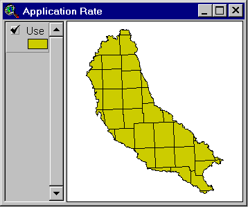
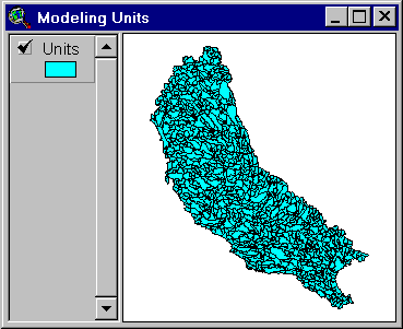
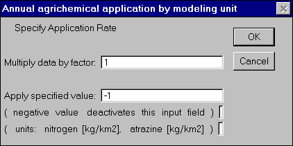
Two spatial resolutions can be used to specify the agrichemical application rate: 1) by county; and 2) by modeling unit. If the view Application Rate is active the application by county may be specified. If the view Modeling Units is active, then the agrichemical application for each unit can be set.
The agrichemical application rate in either all, or selected counties
can be specified. The following dialog box is opened after the button ![]() is
clicked and the view Application Rate is active:
is
clicked and the view Application Rate is active:
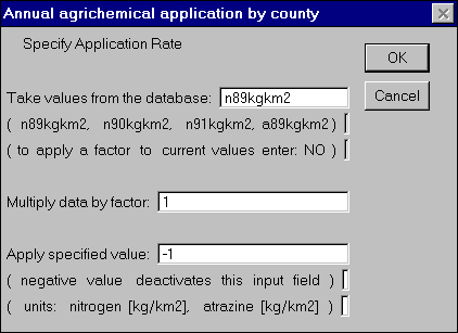
The application rate of nitrogen fertilizers estimated for 1989, 1990, and 1991, and application rate of atrazine estimated for 1989 can be selected. A multiplier that increases/decreases application rate by a given percentage also can be used to simulate the different policy scenarios. The third input field allows one to enter the value of the application rate directly.
: The database of the agrichemical application can be extended by adding an item to the polygon attribute table PAT of the cruse coverage (Table 1).
|
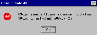
The ArcView model checks the data entered by user. For example, if wrong input is detected in the agrichemical application dialog box, the user will be informed what error and in which entry field the error occurred:
Note: Setting the application rate for the counties change values in modeling units regardless some modeling units are selected of not.
The agrichemical application rate in either all, or selected unit watersheds
can be multiplied by a factor or an application value can be specified.
The following dialog box is opened after the button ![]() is
clicked and the view Modeling Units is active:
is
clicked and the view Modeling Units is active:
Note: Since the average upstream application rate is calculates for each unit, the changes made to one modeling unit affect the values of all downstream units.
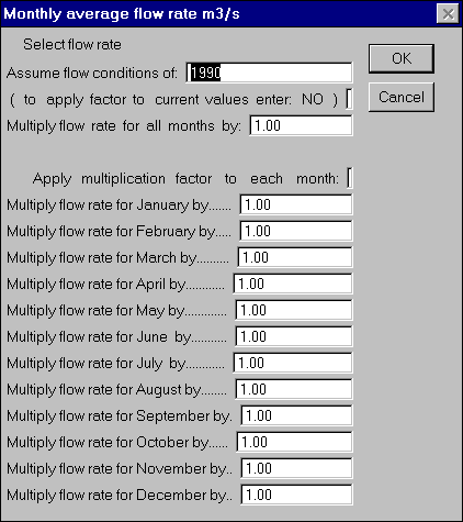
The historical monthly discharge can be extracted from the flow database
(polygon attribute table of the unflow coverage) by specifying
the year and assigned to either all or selected modeling units. Also,
the flow rate values can be multiplied by a factor to represent extreme
flow conditions. The multiplication coefficients can be applied to all
months of the year or to each individual month. The following dialog box
is opened after the button ![]() is
clicked and the view Modeling Units is active:
is
clicked and the view Modeling Units is active:
|
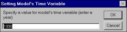
The button ![]() allows
one to specify the year for a model that has a trend component. The specification
of the trend equation is stored in the field Ftrend, file model2a.dbf.
Current version of the agrichemical transport models assume no trend, i.e.
the trend is described by the following equation: 1.00+(0.0000*[Year]).
The following dialog box is opened after the button
allows
one to specify the year for a model that has a trend component. The specification
of the trend equation is stored in the field Ftrend, file model2a.dbf.
Current version of the agrichemical transport models assume no trend, i.e.
the trend is described by the following equation: 1.00+(0.0000*[Year]).
The following dialog box is opened after the button ![]() is
clicked:
is
clicked:
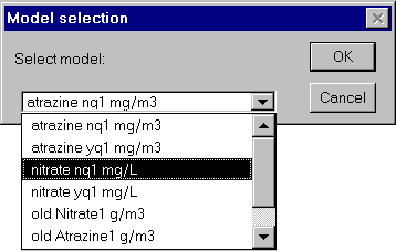
The ArcView model allows to select an equation that describe relation
between atrazine concentration or nitrate plus nitrite as nitrogen concentration
and the variables such as agrichemical application rate, land slope, flow
rate, average temperature and average precipitation. These equations are
stored in the field [equation] of the file model2a.dbf (Table 3).
The following dialog box is opened after the button ![]() is
clicked:
is
clicked:
|
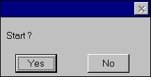
The button ![]() starts
the script that performs the calculations of chemical concentrations and
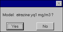
loads. A YES/NO dialog box which ask for model confirmation is displayed:
starts
the script that performs the calculations of chemical concentrations and
loads. A YES/NO dialog box which ask for model confirmation is displayed:
Next, a dialog box is displayed in which user can select months of the year for which the calculations will be performed:
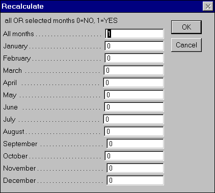
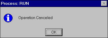
If user selects "Cancel" the calculations of the concentrations and loads are stopped. No changes to the attribute tables are made.
|
The exponential decay model estimates loads in rivers assuming the chemical
losses in rivers are governed by a first order reaction, i.e. the agrichemical
mass exponentially decays as it travels from one modeling unit to the next
downstream unit. After the button ![]() is
clicked a series of dialog boxes are displayed in which user is asked to
select input data and model parameters.
is
clicked a series of dialog boxes are displayed in which user is asked to
select input data and model parameters.
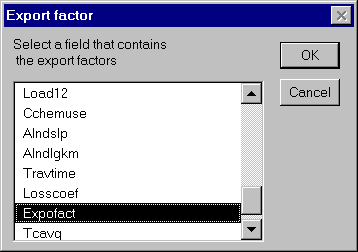
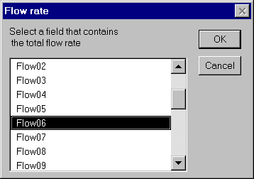
First the user is asked to select a field which contains export factors. The export factors represent all chemical losses after the application on the field and just before the chemical enters a stream.
Next, the user is asked to select a field with the cumulative runoff (river discharge):
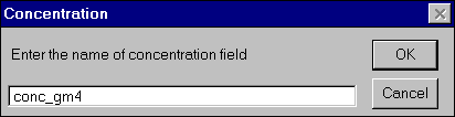
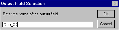
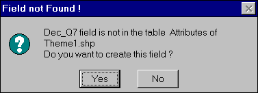
The following dialog box asks for a name or the field in which the results (concentrations) will be stored:
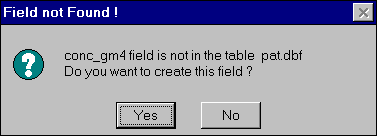
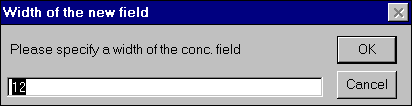
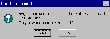
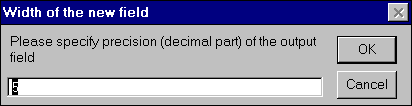
If the field exists, the values will be overwritten otherwise the program asks user if she/he wants to create a new field. If the answer is YES the user will be prompted to specify a width and a precision of the new field.

The travel time (or travel distance) and the time loss coefficient (or distance loss coefficient) are stored in items [Travtime] and [Losscoeff] respectively.
The project Results can be opened by clicking the button ![]() .
This project reserves the space for preparing the maps of estimated agrichemical
concentration and load in surface water. Three scripts, executed from the
button bar, buttons:
.
This project reserves the space for preparing the maps of estimated agrichemical
concentration and load in surface water. Three scripts, executed from the
button bar, buttons: ![]() ,
,![]() , and
, and ![]() , draw
the bar charts of the monthly average chemical concentration, chemical
load and flow rate, respectively. These scripts are based on ESRI examples.
, draw
the bar charts of the monthly average chemical concentration, chemical
load and flow rate, respectively. These scripts are based on ESRI examples.
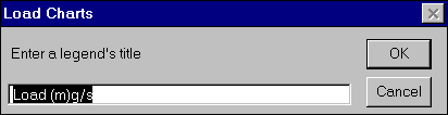
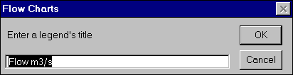
The legend's title can be entered in the following dialog box:
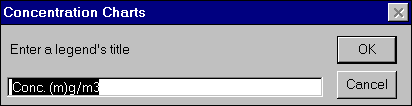
Four sizes of the charts are available: Small, Medium, Large, and X-Large.
Similar dialog boxes are displayed before the charts of loads and discharges are drawn:
|
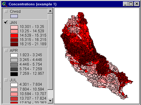
Example of presentation of temporal and spatial distribution of the nitrate and nitrite as nitrogen concentrations in the Iowa River:
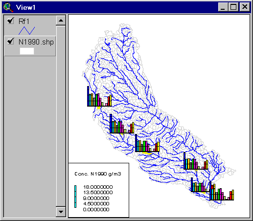
Example of the spatial distribution of nitrate concentrations in the Iowa-Cedar Basin rivers in January 1990. Detection of this characteristic spatial pattern of river pollution (Northwest - Southeast) by the traditional methods is very difficult, ...if possible.
Button ![]() opens
the project Flwprc.
opens
the project Flwprc.
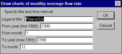
The bar charts that represent the monthly flow rate and the average
precipitation depth for a selected time period can be drawn at the center
of selected modeling units ( ![]() draws
charts of the flow rate and
draws
charts of the flow rate and ![]() draws
charts of the precipitation depth). The script associated with the button
draws
charts of the precipitation depth). The script associated with the button
![]() displays all
recorded flow rate (monthly values from January 1960 to December 1992)
for a specified modeling unit. Since charts of monthly flow rate for multiple
year periods can be drawn, the wet or dry years can be easily identified.
displays all
recorded flow rate (monthly values from January 1960 to December 1992)
for a specified modeling unit. Since charts of monthly flow rate for multiple
year periods can be drawn, the wet or dry years can be easily identified.
After the buttons ![]() or
or
![]() are selected
the user is prompted to enter the name of the legend, and to specify the
time period (months and years):
are selected
the user is prompted to enter the name of the legend, and to specify the
time period (months and years):
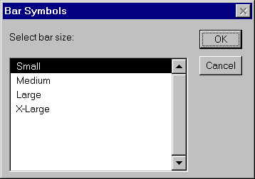
Than the size of the bars must be selected:
|
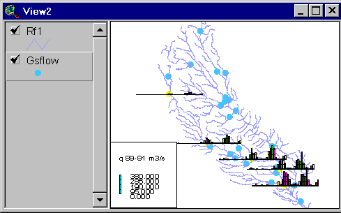
These tools for drawing charts can be used to draw a discharge profiles along selected rivers.
|
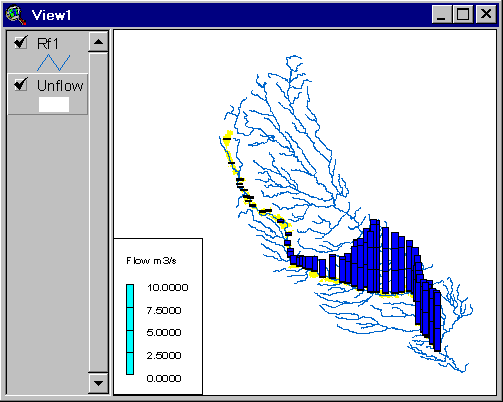
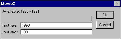
The button ![]() must
be pressed to display all recorded flow rate (monthly values from January
1960 to December 1992) in a form of a dynamic chart. If this button is
pressed, user can click on a selected gauging station, theme gsflow,
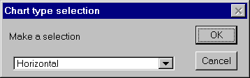
or on a selected modeling unit, theme unflow. Two forms of the
charts can be selected: Horizontal--bars move from right to left, or Vertical--bars
move from up to down.
must
be pressed to display all recorded flow rate (monthly values from January
1960 to December 1992) in a form of a dynamic chart. If this button is
pressed, user can click on a selected gauging station, theme gsflow,
or on a selected modeling unit, theme unflow. Two forms of the
charts can be selected: Horizontal--bars move from right to left, or Vertical--bars
move from up to down.
After chart form is selected the user is prompted to select the time interval for which the data will be displayed.
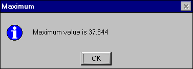
Before the charts are drawn, the maximum value of the discharge is found to scale the chart. This value is displayed:
The dynamic chart is displayed after user click on the YES button:
The process of displaying series of charts can be stopped in any moment by pressing the stop button displayed in the lower left corner of the ArcView window (left end of the status bar).
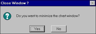
After the data over selected time period is displayed, the user is asked if she/he wants to minimize the chart window:
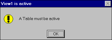
To use a tool a table has to be opened and active. If the active document is not a table an error message is displayed:
The following tools have been created to support the model of agrichemicals in surface waters:
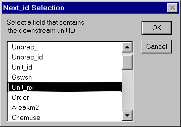
![]() Determines the unit/stream
order in the flow system (Avenue script order6);
Determines the unit/stream
order in the flow system (Avenue script order6);
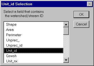
An item that contains the unit ID and an item that contains the ID of the downstream units must be specified:
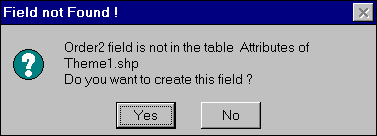
Then user has to determine a field in which the order will be stored:
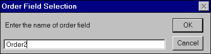
If the field does not exist the program will ask if user wants to create a new field, and display dialog boxes to enter field width and field precision.
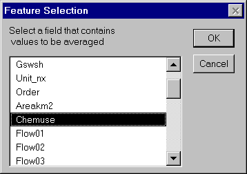
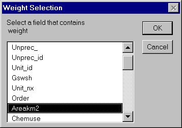
![]() Calculates weighted average
for each modeling unit total drainage area (script upavg2);
Calculates weighted average
for each modeling unit total drainage area (script upavg2);
The following dialog boxes ask user for information required to calculate weighted average:
If the specified field does not exist:
If YES was selected:

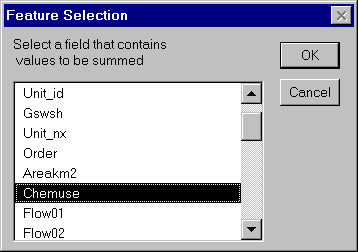
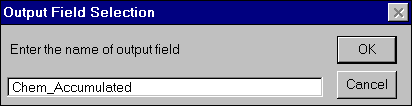
![]() Accumulates values going
along the flow path (script cumul2);
Accumulates values going
along the flow path (script cumul2);
The following dialog boxes ask user for information required to accumulate values along the flow path (flow-accumulation):
If the entered field can not be found:
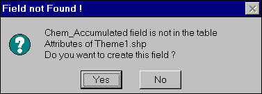
IF answer YES is selected (note that program do not ask for the field precision. To save user time and to reduce number of dialog boxes the script assumes precision of the input field):

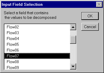
![]() Calculates the difference
between the unit inputs and the unit output (script decom2).
Calculates the difference
between the unit inputs and the unit output (script decom2).
The following dialog boxes ask user for information required to unaccumulate values along the flow path (reverse flow-accumulation):
If the field does not exist:
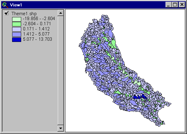
The procedure of reverse flow-accumulation is very useful to determine the difference between the outflow from the modeling units and the sum of inflows, and therefore to asses water gains/losses over large areas. Below an example of "un-cumulated" flow in the Iowa-Cedar River basin for June 1990. The losses along the Cedar River are evident. Also, the dark blue region close to the Iowa City indicates release of water from the Coralville Lake.
These materials may be used for study, research, and education, but please credit the authors and the Center for Research in Water Resources, The University of Texas at Austin. All commercial rights reserved. Copyright 1997 Center for Research in Water Resources.
